
The Cartographer's Annual Vol 6
February ’12
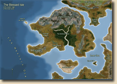
The February Annual 2012 brings you an overland style for creating maps based on quasi-realistic satellite imagery.
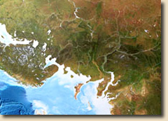
Containing a large selection of new bitmap fills, the style produces beautiful maps simliar to popular wall posters of Earth. Of course it also comes with a full mapping guide explaining how to draw these maps.
The style pack Overland Satellite Maps includes
- 1 new drawing style
- 2 new template wizards (imperial and metric)
- 38 new bitmap fills (29 textures)
- 72 new drawing tools
- 1 new effect setting
- 2 example maps
- 1 5-page mapping guide
- 1 new bitmap fill reference file